Why Walk Cities?
Walking through a city opens up perspectives vehicles can't offer. Streets reveal subtle architectural details, local interactions, and hidden corners — qualities you miss speeding by. About 54% of urban trips worldwide are under 5 miles, proving walkability’s widespread appeal according to the World Bank. Take Copenhagen: its pedestrian zones and cycle lanes cover roughly 39 miles, inviting in-depth exploration on foot or bike.
Walking slows the pace so senses sharpen. You notice the aroma of fresh bread at a sidewalk bakery or overhear a spontaneous conversation in a neighborhood square. This makes cities vibrant stories rather than mere skylines.
Common Missteps
Choosing a city without considering walkability leads to frustration. Visitors often pick places lacking safe sidewalks or pedestrian-friendly routes, resulting in cramped journeys, detours, or reliance on taxis. Crowded tourist zones in places like Venice can overwhelm foot traffic, making walking tedious rather than pleasurable. In some cities, poor signage or inconsistent maps add confusion, forcing detours and wasted time.
Ignoring basic walkability factors often turns exploration into a chore; safety concerns arise at night, and uneven surfaces can make long walks taxing. A favorite spot remains locked behind busy roads or steep hills, turning a simple stroll into uphill combat — literally. These oversights cost valuable exploration hours.
Walk-Focused Tips
Choose Compact Neighborhoods
Compact areas with dense amenities simplify walking. Try neighborhoods like New York’s West Village or Tokyo’s Shimokitazawa. You cover more ground while accessing coffee shops, galleries, and markets within short distances. Many of these hubs average 1–2 miles across, fitting under an hour’s walk without rush. Sidewalk cafés, pocket parks, and local street art thrive here.
Use Local Mapping Apps
Apps like Citymapper and Komoot enhance pedestrian navigation by showing shortest paths, scenic routes, and real-time disruptions. I tested Komoot v12.4 during a Lisbon stroll, discovering a quiet alley with unmatched tile art. Mapping software also highlights accessible paths, avoiding steep slopes or broken sidewalks.
Start Early or Late
Beat crowds by exploring early mornings or late afternoons. Cities like Paris at 6 AM feel peaceful, light casting long shadows on cobblestones. Less traffic and quieter air let you savor sounds and smells more vividly. This timing often reveals live street performances or vendors setting up — fleeting glimpses you’ll remember.
Wear Comfortable, Weather-Ready Shoes
Comfort is non-negotiable. Use shoes with strong arch support and soles matching local terrain; cobblestones demand something sturdier than a summer sandal. Waterproof features helped one rain-soaked morning in Seattle, when temperatures hovered near 50°F and sidewalks slickened unexpectedly. You lose time nursing blisters.
Explore Beyond the Main Streets
Main avenues are great for landmarks but side streets reveal layers of history and daily life. In Rome’s Trastevere district, narrow lanes hold artisan shops and family-run trattorias unseen from tourist routes. Less foot traffic, denser local encounters. Local guidebooks or neighborhood blogs will highlight these stretches that often go unnoticed.
Use Public Transit for Longer Jumps
Walk part, ride part optimizes time and energy. For example, Barcelona’s metro whisks you across town quickly, then you explore specific districts like El Born or Gràcia on foot. This mix works better than exhaustive walking beyond 5 miles, especially in hot weather where tap water becomes a precious commodity.
Carry a Physical Map
Phones die, batteries fade. A printed map or pocket-sized guidebook serves well as a failsafe. Paper maps show the big picture better, invite spontaneous decisions, and keep you from obsessive app-checking, which, frankly, most people skip amid walking bliss. Street names visible on corners often mismatch digital maps, so cross-reference live surroundings.
Stop and Rest Smartly
Parks, plazas, benches—plan breaks. Enjoying a bench at San Francisco’s Mission Dolores Park unexpectedly turned a three-hour walk into a day’s highlight. Fresh air and people watching recharge energy and mental clarity. Spot local coffee shops or small bakeries for a quick snack; hydration strategies matter on warm days as your body expends around 200 calories per hour just walking.
Dress in Layers
Weather changes can thwart outdoor plans. In cities like Chicago, wind tunnels form around skyscrapers; layering protects against sudden chills or heat bursts. Layers adjust quickly — remove a jacket when the afternoon sun rises, put it back after sunset cools the air sharply. Carrying a light pack avoids lugging heavy items while walking.
Real City Walk Examples
In 2023, a tourism company in Lisbon revamped walking tours, focusing on lesser-known routes. They used local mapping apps and timed tours to start pre-dawn. Visitor satisfaction scores rose 40%, and repeat bookings increased by 25%. Walking distances averaged 4 miles per tour with stops every 15 minutes at small venues.
Another example is Kyoto, where a boutique hotel created custom maps highlighting pedestrian paths that avoid steep inclines but show serene temples and gardens. Guests reported walking-based itineraries decreased transit expenses by 30%, increasing local dining spend instead.
Walkability Features Chart
| City | Walk Score | Pedestrian Zones | Avg Daily Walkers (000s) |
|---|---|---|---|
| Amsterdam | 93 | 59 miles | 850 |
| Florence | 89 | 45 miles | 320 |
| Melbourne | 88 | 50 miles | 600 |
| Vancouver | 92 | 30 miles | 500 |
Frequent Errors to Dodge
Starting without testing shoe comfort leads to foot pain halfway. I've seen friends limp silently, ruins pacing for a day’s walk. Skipping water is another error; dehydration sneaks up. Urban heat islands push temps higher unexpectedly. Relying only on digital maps fails too—battery loss or mistaken location data leave you stranded and frustrated. Avoid tourist traps that charge inflated prices and restrict access. Lastly, pre-assuming every street is safe ignores local realities. Check traffic patterns and crime reports.
FAQ
What city has the best walkability?
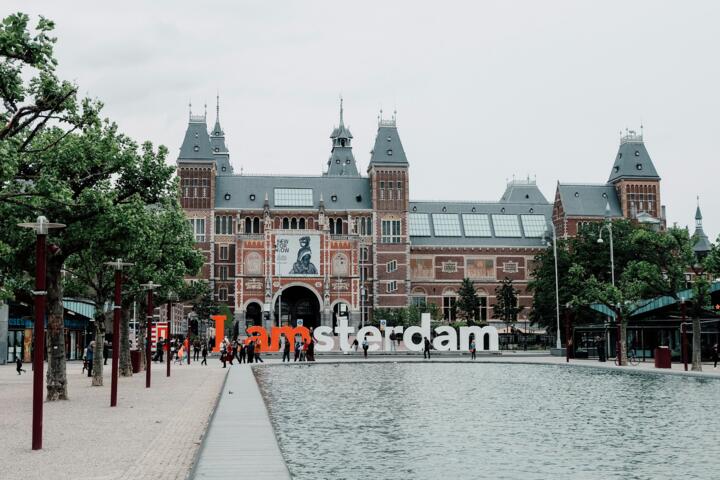
Amsterdam ranks consistently high due to its flat terrain, pedestrian zones, and extensive sidewalks covering over 59 miles, making it accessible and enjoyable on foot.
How far can people usually walk comfortably in cities?
Many can manage 3 to 5 miles comfortably when the environment supports frequent breaks and smooth sidewalks without major elevation changes.
Are walking tours better than guided bus tours?
Walking tours offer immersive experiences highlighting details missed on buses, although buses cover wider distances faster; both have merits depending on goals.
What should I pack for a city walking trip?
Good walking shoes, water bottle, weather-appropriate layers, a physical map, snacks, and a power bank for your phone make a practical kit.
Do all cities support safe walking?
No. Some cities lack proper sidewalks or have heavy traffic, which compromises safety. Research walk scores and pedestrian infrastructure before visiting.
Author's Insight
My personal experience insists on mixing walking with local transit to extend reach without exhaustion. I found early mornings best for photo hunting, avoiding crowds and harsh light. One stumble was ignoring side streets in Brussels, missing out on street art tucked away in alleys. Planning routes with paper maps again—phone dependency fails often. Good shoes and layered clothing shape the quality of any walking day.
Summary
Selecting cities with dense, compact neighborhoods and recognized walk scores guarantees rewarding exploration. Use mapping tools, comfortable gear, and smart timing for more quality miles. Atmosphere and history emerge vividly when you slow down and let your feet lead. Each step adds a story to your travel diary.