Beach Weather Shifts Fast
Beach conditions can change within minutes because the ocean and the land heat up and cool down at different rates, creating local wind systems. A sunny morning can turn breezy as a sea breeze strengthens, then cloud cover can thicken when moisture lifts over warmer air near the shore. Rain and fog often arrive in patches rather than as a single uniform front, so one part of the beach stays dry while another gets soaked.
Local geography speeds up the effect. Cliffs, headlands, and wide bays can steer winds and concentrate moisture, while offshore currents influence how humid the air feels. Even when the regional forecast looks stable, the microclimate near the shoreline can shift because the atmosphere is reacting to temperature gradients that exist only a few kilometers wide.
Practical example: if you arrive at a beach at 10:00 and the air feels calm, a sea breeze may still be building. By late morning, gusts can increase as the land warms, and the wind direction can flip from onshore to more variable. If you’re planning water time, the timing of that shift matters more than the daytime high temperature shown on a standard forecast.
What People Get Wrong
Many travelers treat a beach forecast like a single number that stays true all day. Temperature, wind, and precipitation can change on different schedules, so a forecast that says “partly cloudy” can still produce sudden showers when clouds thicken over the water.
Another common mistake is relying on the “daily” view instead of the hour-by-hour details. Daily summaries smooth out short events, which is exactly what beach weather tends to produce. A 24-hour precipitation chance can look moderate while the actual rainfall is concentrated in a 30–60 minute window.
People also misread wind information. A forecast might show a steady wind speed, but gusts and wind direction shifts are what change comfort and safety near the surf. If you’re checking a marine forecast, pay attention to gust ranges and visibility notes, since fog and low clouds can reduce visibility for swimmers and boat traffic.
Supporting dependencies matter. Forecast models use sea surface temperature, land cover, humidity profiles, and upper-air winds; when those inputs vary over short distances, the forecast uncertainty increases near the coast. That uncertainty grows when the sky is partly cloudy, because small differences in cloud formation can change whether rain reaches the beach.
Even the tools differ. A weather app may show a “feels like” temperature that blends wind and humidity, but it can lag behind real conditions by several minutes, which feels longer when you’re standing in the wind. I’ve seen this on version 2024.10 of a popular app interface, where hourly updates arrived in bursts rather than continuously.
How To Plan Around It
Check Hourly Wind And Rain
Use the hourly forecast for wind speed, gusts, precipitation type, and timing. Look for patterns like “wind increasing” or “showers ending” rather than only the overall chance of rain. If the forecast shows gusts rising after midday, plan your longer beach time earlier, then shift to sheltered activities when gusts pick up.
For rain, check whether precipitation is shown as rain or showers and whether it’s clustered in a short window. A forecast that indicates brief showers can still mean wet towels and slippery walkways, so bring a dry bag and plan a quick retreat route.
When you check, compare two sources if possible: a land-based forecast and a marine or coastal forecast. If both agree on wind direction and timing, you can treat the plan as more stable. If they disagree, treat the day as variable and keep flexible timing.
Watch Sky Cues Near Shore
Forecasts help, but shoreline cues often tell you what the models haven’t resolved yet. Darkening clouds that move quickly toward the coast can signal a short-lived rain band, while a sudden drop in visibility can mean fog or low stratus is forming over cooler water.
Wind shifts are another cue. If the wind changes direction and the air feels noticeably cooler or more humid, the sea breeze may be strengthening or a new wind regime may be arriving. That shift can also change wave conditions, so avoid assuming the surf will stay the same.
Personal aside: on a trip in late August 2023, I noticed that the “calm” period ended about 20 minutes after a line of higher clouds reached the horizon. The hourly forecast had not flagged a gust increase until later, which made the difference between a comfortable walk and a wet, windy scramble.
Use Simple Safety Triggers
Set triggers that tell you when to leave the water or move to shelter. If wind gusts rise enough to make it hard to stand comfortably, treat that as a cue to reduce time in exposed areas. If you see lightning or hear thunder, leave the beach area and seek shelter well away from open sand and tall objects.
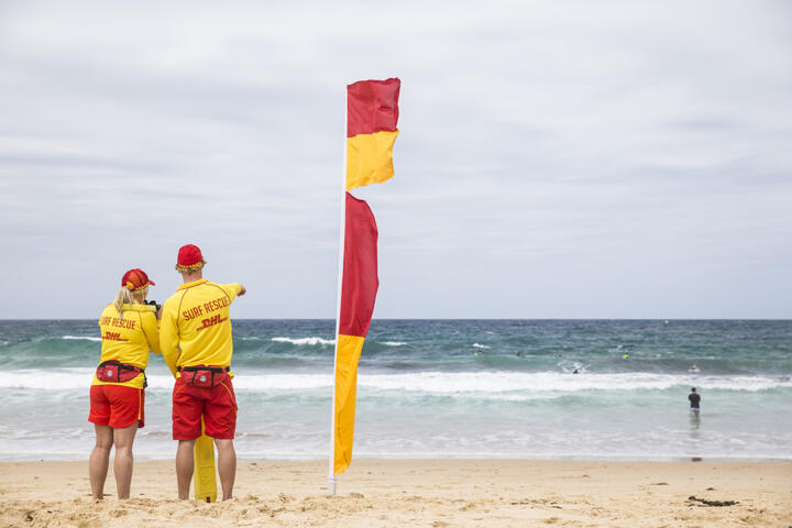
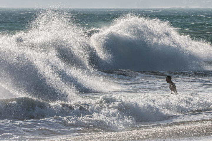
For swimmers, watch for sudden changes in wave behavior. Stronger onshore winds can increase wave chop and make it harder to return to shore. If you’re near a lifeguarded area, follow their guidance; if there’s no lifeguard, be conservative and shorten swim sessions when conditions turn.
Practical numbers vary by location, but a common rule is to keep an eye on gusts and visibility. If visibility drops enough that you can’t clearly see landmarks across the beach, fog or low cloud is likely, and that reduces situational awareness.
Pack For Rapid Changes
Plan for the “two weather days in one” scenario. Bring a light rain layer that blocks wind, a hat that handles gusts, and footwear that works on wet sand. A small towel or quick-dry cloth helps you reset after brief showers.
Use a dry bag for phone and valuables, since short downpours can happen even when the rest of the day stays mostly dry. If you’re using sunscreen, reapply after sweating or after you get wet; water-resistant products still wear off over time.
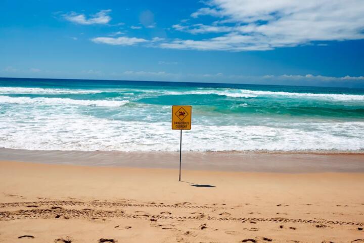
Check local advisories before you go. Coastal hazards like rip currents, high surf, and beach closures are often posted by local authorities and lifeguards. Weather changes can trigger those hazards quickly, and the advisory is usually more actionable than a general forecast.
Case Examples From Real Patterns
Scenario 1: Wind shift after a calm start. A traveler arrives at a bay beach at 9:30 with light onshore breeze. The hourly forecast shows wind increasing after 11:00, but the daily view looks stable. Around 11:10, gusts become noticeably stronger and the wind direction turns more directly onshore, making the surf choppier. The traveler moves to a sheltered section and shortens swimming time until gusts ease.
Scenario 2: Patchy showers near a headland. A group plans a lunch picnic at 12:30. The forecast indicates a moderate chance of rain, but the hourly view shows showers concentrated between 12:00 and 13:00. Clouds thicken over the water first, then a brief shower passes through one side of the beach while the other side stays dry. They use a dry bag for food and shift to an indoor café for 20 minutes, then return when the shower line moves on.
Checklist For Decision Support
| What To Check | What It Means At The Beach | How To React | Red Flags |
|---|---|---|---|
| Hourly wind + gusts | Gusts change comfort and surf conditions | Plan water time earlier; move to shelter when gusts rise | Wind direction flips and gusts spike |
| Hourly precipitation timing | Showers can be short and patchy | Bring dry storage; keep a retreat option for 30–60 minutes | Rain starts faster than expected |
| Visibility / fog notes | Low clouds reduce situational awareness | Avoid long swims; stay near known landmarks | Landmarks disappear or visibility drops suddenly |
| Local beach advisories | Rip currents and closures can change quickly | Follow lifeguards and posted flags | Warnings posted after you arrive |
If you only do one thing, check the hour-by-hour wind and rain timing, then build your plan around the window when conditions are most likely to be uncomfortable or unsafe.
Common Mistakes To Avoid
Relying on the “feels like” number without checking wind gusts can mislead you. A calm-looking forecast can still produce gusty periods that make the air feel colder and increase wind-driven spray.
Assuming that a low rain chance means “no wet weather” leads to avoidable problems. Coastal showers can be brief and localized, so you can get wet even when the overall probability looks modest.
Ignoring visibility cues is another frequent error. Fog and low clouds can form quickly near the water, and reduced visibility affects navigation, swimming safety, and even how quickly you can spot hazards.
Overpacking for one weather scenario also backfires. If you bring only warm layers for a cool morning, you may overheat when the sea breeze weakens. If you bring only light clothing, you may get chilled when clouds thicken and wind increases.
Finally, treating a single forecast update as final can be frustrating. Weather apps sometimes update on a schedule, and the next update can arrive after you’ve already committed to a plan—so build flexibility into your timing.
FAQ
Why does the wind change first?
Sea breezes form when land warms faster than water, creating pressure differences that drive onshore winds. As that temperature contrast strengthens or weakens, wind speed and direction can shift before clouds or rain arrive.
Do daily forecasts work for beaches?
Daily forecasts help with broad expectations, but they smooth short events. Hour-by-hour wind, gusts, and precipitation timing usually match beach conditions better, especially for brief showers.
How can I tell if fog will form?
Check forecasts for visibility and low cloud or fog mentions, then watch for a sudden drop in how far you can see across the water. Fog often develops when moist air cools near the surface.
What should I do if rain starts suddenly?
Move valuables into a dry bag, protect electronics, and shorten exposure time in open areas if wind increases. If lightning is present, leave the beach area and seek shelter away from tall objects.
Are rip currents related to weather changes?
They can be. Changes in wind and wave patterns can alter currents near shore, and local lifeguards or authorities may post updated warnings when conditions shift.
Author's Insight
Beach weather changes quickly because coastal areas combine strong temperature contrasts with complex local airflow around shorelines. Hour-by-hour forecasts, marine or coastal notes, and local advisories often give more actionable detail than daily summaries.
Forecast uncertainty is higher near coasts when clouds and precipitation are patchy, so travelers benefit from planning for short disruptions rather than assuming one stable condition all day. A practical approach is to schedule the most exposed activities during the most stable forecast window and keep a short retreat plan ready.
If you want a simple habit, compare wind gust timing with precipitation timing and treat gust increases as a cue to reassess water safety. That method works even when the sky looks calm at first.
Key Takeaways
- Beach conditions shift fast due to sea-breeze dynamics, local geography, and patchy cloud or rain patterns.
- Use hourly wind gusts, precipitation timing, and visibility notes; daily summaries often hide short events.
- Watch for wind direction changes, darkening clouds, and reduced visibility, then adjust plans immediately.
- Follow local beach advisories and lifeguard guidance, since hazards can change faster than forecasts.
- Pack for quick changes: wind-resistant rain layer, dry storage, and a flexible retreat option.